
Trace a Burke Street
Fairfax keeps address records in several systems because each one has a different function. The county assigns and validates addresses for emergency response and mail. The tax roll connects an address to a parcel. The map shows parcel geometry and county layers. Land records preserve recorded parties and legal descriptions. A voter record is governed by a separate, restricted system. For an old Burke address, a reverse directory can supply an earlier address-based clue. Used in order, these records make a more reliable street-by-street trail than a single name result.
- Confirm the number, street name, and suffix through Fairfax County’s addressing and street-name service. A changed street name can appear in GIS, MAR, and PLUS before every other county system updates.
- Search the address in Fairfax iCare. Save the PIN, situs, owner, mailing address, land use, and legal description rather than assuming the owner occupies the site.
- Open the Digital Map Viewer, also called Jade, zoom to the parcel, and click it and any adjoining lots. Compare the layers and each parcel report.
- Use the owner, legal description, and book or instrument details to search Fairfax Circuit Court land records. Follow a purchase deed back through the prior grantor only when the parcel description still matches.
- Do not turn the Virginia Citizen Portal into a street roster. It is a self-lookup tool, and voter-list products are limited by Va. Code §24.2-405.
- For an earlier period, search Virginia Room criss-cross and telephone directories by street and number, then test the dated entry against the deed and parcel trail.
That sequence recognizes the difference between a recorded owner, a tax correspondence address, a historical subscriber, and a current resident. Those categories often overlap, but Fairfax does not publish one universal household roll.
Search Burke Streets in iCare
Fairfax Department of Tax Administration iCare is the main public starting point for a modern Burke street search. Its address mode separates Number, Unit#, Street, and Suffix. County instructions say to leave the suffix off for broader results. An asterisk can widen a street-name search, while adding a street type can narrow it. iCare also offers owner, map-number, and map modes, plus neighborhood and sales tools. Results lead to parcel, ownership, legal-description, sales, values, tax, and printable views.
| iCare field | Input type | When required | Burke search use |
|---|---|---|---|
| Property Location | Mode | Address search | Opens the Number, Unit#, Street, and Suffix form |
| Number | Text | No | Use the street number when known |
| Unit# | Text | No | Add an apartment or unit only when it is part of the address |
| Street | Text | No | Omit suffix for best results; iCare accepts * wildcards |
| Suffix | Select | No | Street-type selector for a narrower search |
| Map Number | Text mode | In map-number mode | Accepts full or partial PIN patterns such as 123* |
The iCare address form shows the separated search controls used for a Burke street directory search.
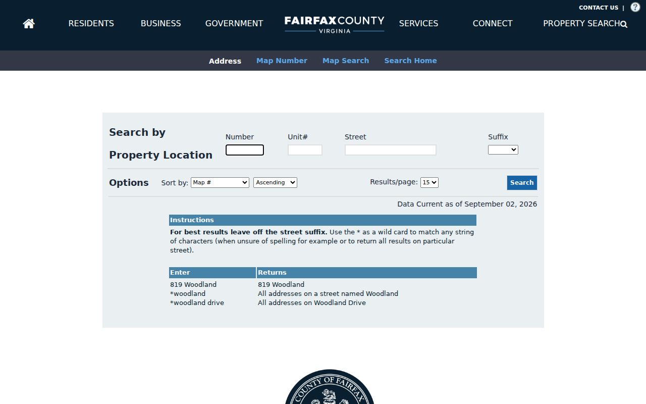
Its field layout is useful because a partial street search can return several parcels without converting the result into a list of occupants.
iCare data is updated twice weekly. The county permits an owner to ask that the owner name be withheld from internet display. An assessed value is a county assessment field, not a current market conclusion.
Read Burke Address Identities
A Burke property can carry three address identities. The situs identifies the physical parcel or building. The mailing address is where the county sends tax-owner correspondence. The legal description and PIN identify the land in deeds, plats, and tax maps. The latter two can outlast a postal-label change or a street-name variation. The sample parcel at Burke Centre Parkway demonstrates the point: the listed owner is Burke Centre Conservancy, its mailing address differs from the parcel situs, and the land use is private open space. That record does not establish a household at the site.
The Burke parcel report displays the kind of situs, owner, map-number, land-use, and legal-description fields that need to be kept separate.
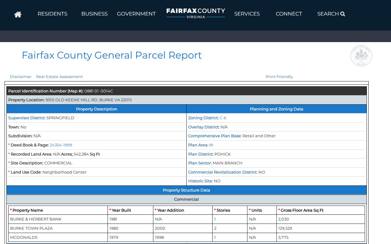
A mailing address may belong to an association, manager, business, or owner elsewhere. It is a locating clue, not proof of occupancy.
Map Burke Street Parcels
Jade, Fairfax County’s Digital Map Viewer, is designed for map inspection rather than a linear name search. It provides pan and zoom tools, address or place search, layer selection, parcel click or identify actions, selection controls, and print or export options where available. Its many county layers can add zoning, ZIP, precinct, supervisor district, watershed, schools, and plan context. Start with a parcel click, then open the underlying report. A nearby polygon on the map may be common space or a separate tract rather than another household lot.
The Fairfax Digital Map Viewer shows the map and layer controls available for a street-by-street parcel review.
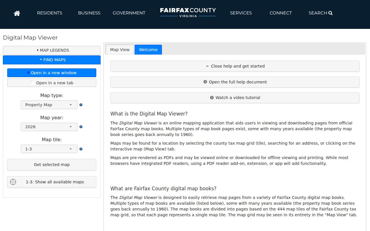
Clicking each target parcel keeps the map evidence tied to a PIN and legal description instead of relying on visual proximity alone.
Fairfax My Neighborhood can add public context such as precinct, schools, elected officials, and nearby facilities. It is not a household directory, so it belongs after parcel verification rather than in place of it.
Keep Burke PINs With Records
A PIN is Fairfax’s parcel identification number. It can be up to 15 characters and carries a tax-map or grid component, subdivision, block, lot or parcel, and sublot. Leading zeros and spaces matter. Recording the PIN along with the current situs gives a street search a stable bridge when an old volume uses a different locality label or when a later subdivision changes the appearance of the address.
- Parcel
- A defined piece of land in the tax-map system, identified by a PIN and linked to a parcel report.
- Situs address
- The physical location of the land or building used by iCare, GIS, permits, code cases, and county services.
- Plat
- A recorded map that can show lots, blocks, or a subdivision when an address trail moves through a parcel change.
- Criss-cross directory
- A reverse directory arranged by street and number, used to find a historical subscriber, household, or business clue from an address.
Note: A PIN supports parcel continuity, but a split, merged, or re-platted tract can still require a deed and plat review.
Follow Burke Deed Records
Land records provide the recorded ownership trail behind an address. Begin with the current iCare owner and legal description, find the acquisition instrument in the Circuit Court grantor-grantee index, and write down the grantor, recording date, instrument number or book and page, and description. Then search that grantor as an earlier grantee. Search spelling variants, initials, DBA, AKA, FKA, and trustee entries because Fairfax indexes names as typed and marks trustees with TR. A recorded party is still not automatically a current resident.
The Fairfax land-records research page explains the split between the Research Room, CPAN, public terminals, and the Historic Records Center.
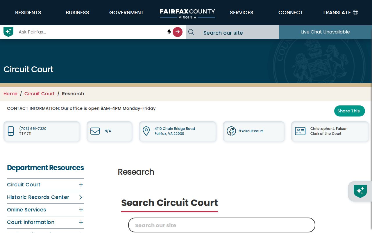
Fairfax deeds run from 1742 to the present. Original HRC deed books cover 1742 through 1942, while the data index covers 1980 forward and book 5391 onward; older index-book images cover 1742 through 1979. Those access layers explain why a single online search may not expose every image.
The Research Room is at 4110 Chain Bridge Road, Suite 317, Fairfax, with public CPAN terminal access. The Historic Records Center uses the same address for original books and copy help, so the best route depends on the deed’s date and whether an index, image, or original volume is needed.
For a copy, supply the instrument number or book and page. The circuit court accepts a written request or Land Records Copy Request Form by mail, and the research lists a stated two-week mailed-copy estimate.
The Fairfax land-records copy instructions set out the request and payment route for a recorded instrument.
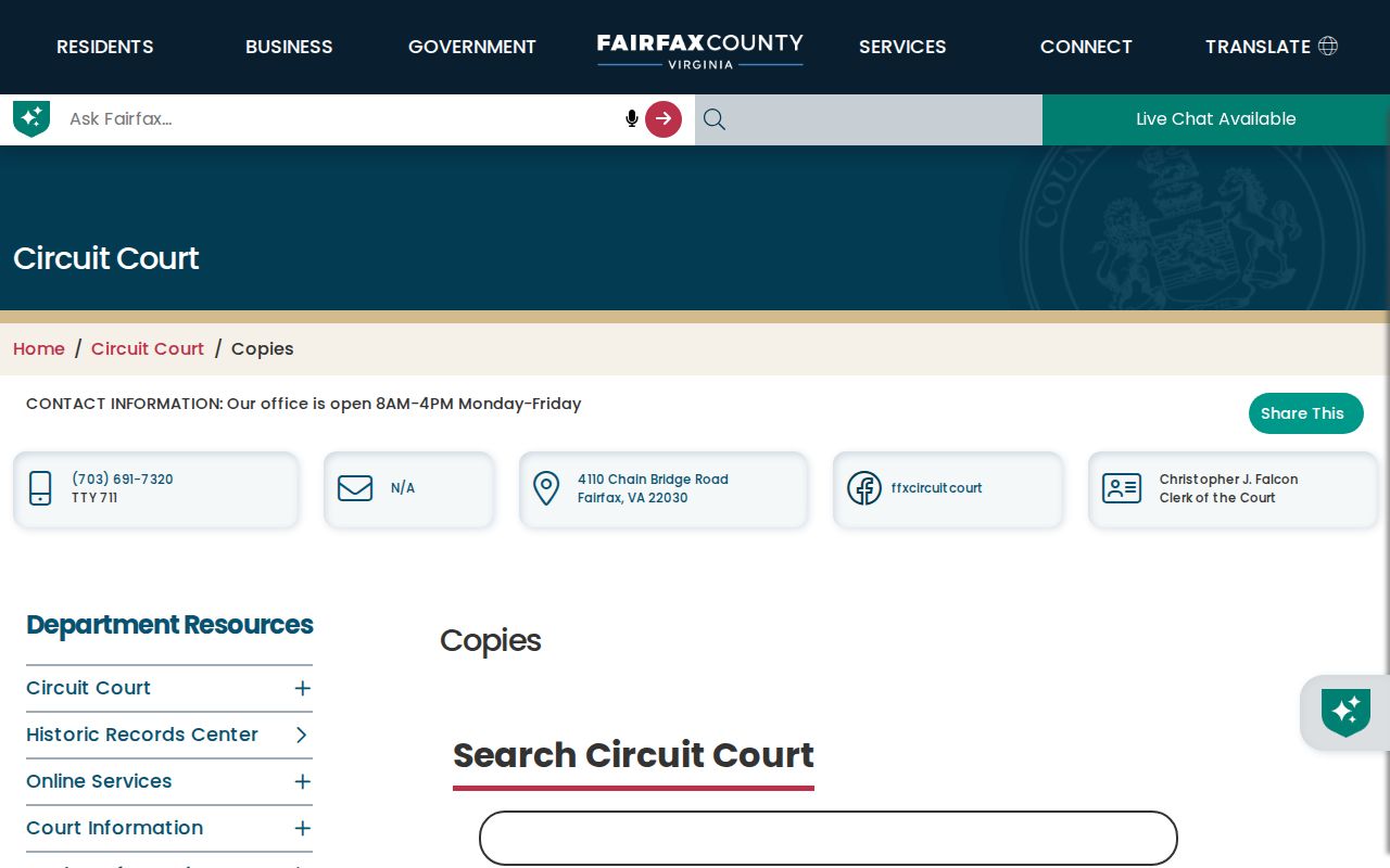
A precise book, page, or instrument reference lets the clerk locate the correct record without turning a copy request into a broad name search.
Check Burke Permit Addresses
Fairfax PLUS can add a construction or development timeline to an address. Its public search includes Site Address, Parcel Number, and Record Information tabs, along with Street Number, Street Name, Street Type, Unit Number, City, State, ZIP Code, Parcel ID Number, dates, project name, record type, and contractor-license fields. A permit can identify a project, applicant, contractor, inspection, or site address. It does not supply a complete roster of people living at the property, and older history is handled outside the current PLUS route.
Use the Fairfax PLUS public search after preserving the parcel ID. Dates and project descriptions can help distinguish a physical change from a change in ownership or residence.
Request Burke Code Records
Code Compliance records are also keyed to an address, but access is narrower and case material can be redacted. Fairfax’s DCC VFOIA form asks for the property address or record number, a description, desired materials such as notices, investigation reports, photos, the initial complaint, or a complete case file, and a preferred delivery method. Certain complaint identities receive statutory confidentiality treatment. Request only the specific record needed and expect possible actual costs.
The DCC VFOIA request route documents those categories. For a general county request, Virginia Freedom of Information Act procedure includes a five-working-day response rule, subject to statutory extensions and exemptions.
Note: Address-keyed code material can document a case or project, but it does not establish who occupied the address.
Read Burke Station Street Labels
Older address research needs Burke’s local vocabulary. County history ties Burke Station to the Orange and Alexandria Railroad and the name of Silas Burke. A directory, map, or deed may instead use Burke Station, Old Burke Lake, Burke Road, Fairfax Station, Springfield, or another nearby label for the same general area. Treat each as a search term, then return to the PIN, legal description, plat, and document date before deciding that two entries describe the same parcel.
Fairfax record keeping reaches back to the 1740s, and its early deed books can contain commissions, bonds, trusts, bills of sale, and other material as well as transfers. The Fairfax historic-marker material is useful context for historic place names, while the land-record trail remains the evidence for a specific address.
Use Burke Criss-Cross Clues
When the goal is historical, Virginia Room reverse directories and telephone books provide the right key: street first, then number. Fairfax’s local-history collection includes selected regional Hill’s criss-cross runs from 1957 through 1975, Burke Community Directory runs from 1981 through 1995-96, Burke Centre Resident Directory volumes for 1979, 1981-83, and 1988, plus regional telephone runs. Inclusion varies by locality and volume. An entry can be a subscriber, business, or association-era household clue, not a complete population count.
The Virginia Room is on the second floor of City of Fairfax Regional Library and provides a microform reader, internet stations, a CPAN station, and local-history collections. It is the practical fallback when a Burke city office does not hold an old address directory.
A dated directory result is most useful when paired with the parcel’s legal description or a deed. That comparison prevents a same-number street entry from being mistaken for the same parcel after a rename or subdivision.
Compare Burke Street Records
Each address-keyed source answers a limited question. Keep the source and its limit next to every note. A whole-street review is strongest when it follows parcel identifiers, not when it attempts to combine unlike records into an unsupported household list.
| Address key | Fairfax source | What it can show | Important limit |
|---|---|---|---|
| Situs or PIN | iCare parcel card | Owner, mailing address, legal description, assessments, sales, and physical data | Owner is not necessarily an occupant; a name can be withheld online |
| Geometry or PIN | Jade/Digital Map Viewer | Parcel edges, neighbors, districts, zoning, ZIP, and precinct layers | Map geometry is not household composition |
| Book, page, or instrument | Circuit Court land records | Grantor, grantee, recorded transfer, and legal description | Images and older books use CPAN, a terminal, or HRC |
| Site address or parcel | PLUS and DCC | Permit, inspection, project, or case clues | Older records, costs, and redactions can apply |
| Street, number, and year | Criss-cross directory | Historical address or subscriber clue | Coverage and inclusion vary by volume |
The detailed reverse-directory holdings are discussed on the Burke city directory page when an address trail needs a year-by-year historical source.
Respect Burke Voter Limits
Virginia’s Citizen Portal is built for a person to verify their own registration and election information. It requires name, date of birth, the last four digits of the Social Security number, locality, and a certification step. It is not an open street directory. Under Va. Code §24.2-405, voter-list products are available only to listed requester categories and purposes. The request form filters by locality, district, and election rather than offering a normal public street query.
Household members may be absent from a deed or property record, and protected voter data should not be reconstructed through address matching. DMV and utility customer information are not public substitutes.
Set Burke Street Boundaries
A Burke street directory can establish parcel facts, recorded land parties, historic address clues, and project records. It cannot prove every person living at an address. Unlisted residents, protected participants, private utility customers, and people absent from the relevant record set may not appear. A no-result can reflect the source’s date, coverage, geography, indexing, or access rule rather than a conclusion about a person.
Note: When an official route ends, ask the record custodian for the specific available record instead of treating a missing web result as proof.