
Burke Neighbors Block Sources
The most useful official block evidence is parcel-based. Fairfax County's map tools show land geometry and county layers, while iCare supplies the related parcel and tax fields. My Neighborhood adds public geography, such as a precinct and nearby facilities. None is a household roster. Historical reverse directories and association materials can sometimes supply a dated community clue, but coverage varies by year, street, and membership. Keep the source's exact purpose in view before treating a name as a current neighbor.
| Source | Block signal | Access |
|---|---|---|
| Jade / Digital Map Viewer | Touching parcels, county layers, districts, and zoning | Free map browse |
| iCare parcel and Neighborhood Search | Parcel fields and same-neighborhood sales context | Free parcel link |
| My Neighborhood | Officials, precinct, schools, facilities, and public resources | Free address report |
| Voter-list request | Defined voter-list products by locality, district, or election | Restricted statutory request |
| Association and directory materials | Community names, voluntary contacts, or dated address snapshots | County list or Virginia Room |
Burke is a Fairfax County census-designated place, not an incorporated city, so the county is the records jurisdiction. A parcel owner may receive tax mail elsewhere, and an owner may have no current residential connection to the lot. Conversely, an occupant may not appear in a deed or property card. A careful Burke neighbor lookup describes only the relationship a source actually documents.
Map a Burke Neighbor Block
Fairfax County's Digital Map Viewer, also called Jade in the county parcel workflow, is the starting point for adjoining lots. Search or pan to the target address, identify the target parcel identification number, then zoom until the parcel edges are clear. Click every touching or nearby parcel rather than assuming that a row of addresses or a map label represents the same subdivision. The viewer supports parcel identification, address or place search, pan and zoom, layer selection, selection and clear actions, and data-table or export behavior depending on the map.
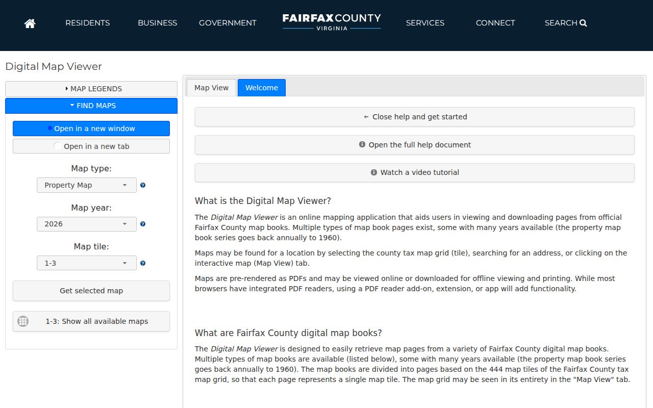
The selected geometry is a map fact, not a people fact. Use layers for subdivision, ZIP code, voting precinct, supervisor district, zoning, watershed, and similar county context. A road, common tract, or open-space parcel can separate lots that look close at a broad scale. The legal description and parcel boundary help distinguish a true adjoining lot from a nearby parcel across such a feature.
- Find the target address and record its PIN before opening nearby records.
- Zoom to the parcel boundary and click each touching or relevant nearby lot.
- Open the parcel report for each selected lot and retain its PIN, situs, owner, mailing address, land use, legal description, and tax district as separate fields.
- Compare the map layers only after the parcel reports are open. For a complete named-street trail, use the Burke street directory.
Parcel Fields for Burke Neighbors
A Burke Jade parcel report shows the record categories that make an adjacent-lot check useful: situs, owner, map number, land use, legal description, parcel information, sales, values, tax, and printable summary information. The PIN is the stable bridge between the mapped lot and the county record. A Fairfax PIN can be up to 15 characters and includes tax-map, subdivision, block, lot or parcel, and sublot components. Preserve leading zeros and spaces when copying one.
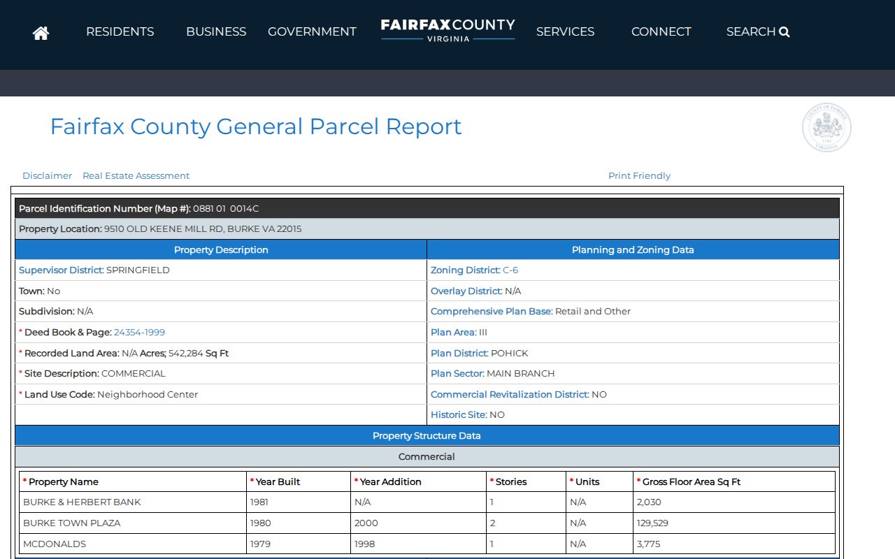
The three address labels need different treatment. Situs is the physical parcel or building address used by county services. Mailing address is the tax correspondence address and can be in another locality or belong to an association office. Legal description identifies the recorded land through a lot, block, subdivision, or other land description. An owner field is not a universal list of occupants, and iCare allows an owner to request removal of the name from internet display.
- Parcel or PIN
- The county's stable identifier for the tax-map parcel.
- Adjoining parcel
- A lot that shares a boundary or is selected as nearby on the map; confirm the geometry before calling it adjacent.
- Land use
- The county classification for a parcel's use, not a roster of people connected with it.
Burke Neighbor Public Context
Fairfax My Neighborhood provides a simpler address report. Enter an address and choose Search, or use Get report by map click and Show Map. The optional points-of-interest control adds public locations. The report can return elected officials, a voting precinct and polling location, assigned schools, the nearest police and fire locations, and two nearby libraries, post offices, hospitals or urgent-care facilities, and parks.
Those results explain the public geography around a block. They do not list nearby households or current residents. A precinct is an election boundary, and a school assignment or facility result is a service-area fact. Use My Neighborhood to understand the address context after identifying parcel boundaries, not to reconstruct a private block roster.
Burke Neighbor Sales, Not Names
Fairfax iCare's address search accepts Number, Unit, Street, and Suffix fields. County guidance says to omit the suffix for the best results and permits wildcard searching for street-name variants. An individual property profile can show owners, parcel information, legal description, sales, values, tax, record navigator, neighborhood search, neighborhood sales, and printable views. Assessed values, physical characteristics, and sales dates or prices are public under Virginia Code § 58.1-3122.2, and data are updated twice weekly.
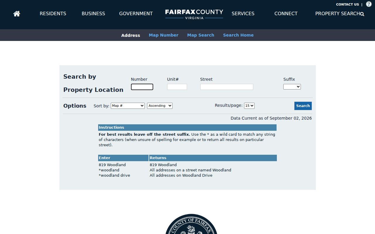
Neighborhood Search and Neighborhood Sales add same-neighborhood sales context. They do not return a people list. An assessed value is also not a market-value conclusion, and a tax-mailing field is not occupancy proof. If a parcel changed hands, compare the recorded sale date, the legal description, and the PIN before connecting it to another block record.
Burke Voter Lookup Block Limits
The Virginia Citizen Portal allows a voter to view that voter's own record after an identity-based lookup and certification. It is not a map of all voters on a Burke block. Virginia Code § 24.2-405 limits voter-list products to listed requester classes and purposes. An eligible requester can use the state voter-list request form for defined filters and products, but full dates of birth, Social Security numbers, and protected addresses are not a neighborhood-search feature.
No official source located an ordinary public block-by-block voter web map or a public Burke historical poll-book block index. Do not convert a precinct boundary into a list of voters, and do not attempt to match protected voter information to parcel data. The local registrar is the route for a voter record correction.
Burke Neighbor Association Contacts
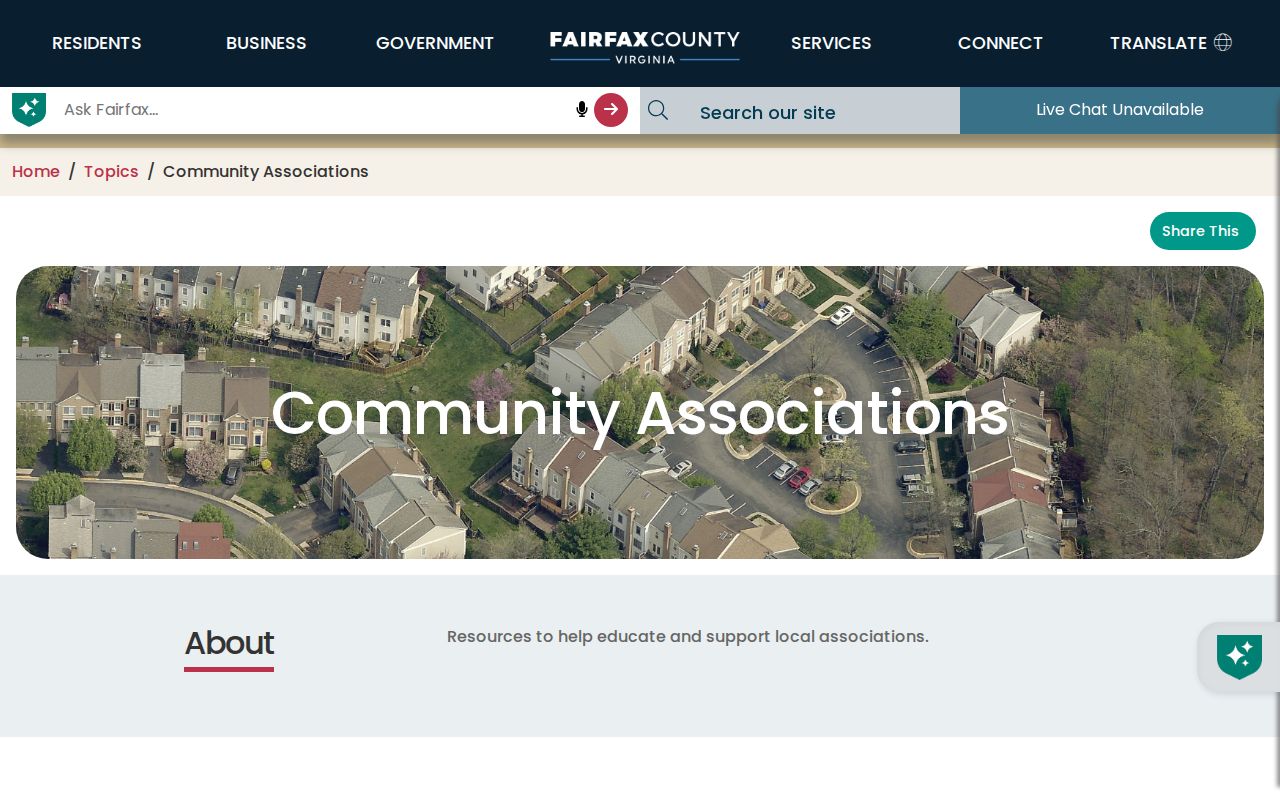
Fairfax County's Community Associations page distinguishes property owners' or homeowners' associations, condominium unit owners' associations, real-estate cooperatives, and voluntary civic, citizens, or neighborhood associations. Fairfax does not govern HOA or condominium operations and keeps a voluntary association list. The listed names and supplied contact or street information are useful community leads, not public member directories.
Burke Centre Conservancy is the umbrella planned-community association and is listed at burkecentre.com. County materials also distinguish Burke Centre Conservancy variants for Commons, Landings, Oaks, Ponds, and Woods. Treat those as community-governance names, not separate household databases. The table collects the associations and cautions documented in county material.
| Association or community | Public contact or block signal | Directory limit |
|---|---|---|
| Burke Centre Conservancy | Umbrella association; county list and conservancy website | Historic resident directories exist for selected years, not a current public roster |
| Commons, Landings, Oaks, Ponds, and Woods | Burke Centre village or association variants in the county list | Do not assume separate public membership files |
| Burke Centre Station Commons and Burke Cove CUOA | Named in the county association list | Current member directory not located |
| Burke Estates HOA, Burke Hills Lake Association, and Burke Lake Cluster HOA | Listed community-association names | Public member-directory status not located |
| Cherry Run and White Oaks | County community references; verify the association street list | Center locations do not establish association boundaries |
Association submissions are voluntary. The county update form asks for the legal name, membership type, district, mailing contact, annual meeting, household count, website, and streets within the association. An association is not required to provide that information, and any resident or member list remains association-controlled, possibly behind membership or a login.
Burke Neighbor History by Address
For a past block, the Fairfax County Public Library Virginia Room holds criss-cross directories, telephone books, neighborhood and community directories, newspapers, maps, yearbooks, and related local-history material. A criss-cross volume may place a dated subscriber or address entry on a street. The Burke Centre Resident Directory has selected historical holdings from 1979, 1981, 1982, 1983, and 1988. Such entries are snapshots of a particular title, geography, and year, not a current household list.
Pair an older address entry with the matching parcel PIN or legal description and a deed, probate, or newspaper record where appropriate. A directory volume can cover Fairfax, Springfield, Annandale, or another nearby geography while still including some Burke addresses. For that reason, record the title and year before treating a street result as a neighborhood connection. The Burke city directory collections provide the historical shelf rather than a current-neighbor search.
Privacy Limits for Burke Neighbor Lookups
Official block records have clear limits. Parcel sources identify land and tax fields. My Neighborhood supplies public geography. Association lists identify organizations that voluntarily submitted details. Commercial neighbor-lookup tools, as a category, may repackage address and public-record data with varying accuracy, update timing, and legal terms. They do not expose protected residents, unlisted occupants, or private utility and delivery accounts.
| Official block source | Commercial neighbor-lookup category | Limit to remember |
|---|---|---|
| Names its custodian and specific field set | May combine data from several dates and sources | Check the original custodian record |
| Maps a parcel or reports public geography | May imply a household composition | Parcel ownership does not prove occupancy |
Virginia's Address Confidentiality Program in § 2.2-515.2 provides a substitute mailing address for qualifying participants, and voter-list rules also protect information under § 24.2-405. The Virginia Consumer Data Protection Act, § 59.1-571 et seq., applies to covered-business data practices; it does not force a county custodian to disclose restricted fields. Correct a parcel issue through DTA or iCare, a voter issue through the registrar, and an association-list issue through the association or county process that holds the record.
Lawful use. A Burke neighbor lookup is for personal, lawful property or community research. Never use a parcel, address, or association detail to watch, stalk, harass, intimidate, or harm another person.